Sunday, March 11, 2007

Kinder Scout Walk From Hayfield

(An article on Kinder Scout can be found at Wikipedia:- http://en.wikipedia.org/wiki/Kinder_Scout )


Instead of going off for a walk on my own today, I went on a group walk organised by the Peak District Ranger's Service. Ian Milne, Asst Park Ranger and our group leader for the day met us at Bowden Bridge Car Park and gave us a brief outline of the day's itinerary and a handout on the history of what we would come across on our walk.

Our route from Bowden Bridge quarry car park, Hayfield;- Mount Famine, South Head, Brown Knoll, Swine's Back, Edale Rocks, Kinder Low, Red Brook Gorge, Kinder Downfall, Sandy Heys, White Brook. Approx 10 1/2 miles.


Plaque of Mass Trespass 1932

"Guardian News" report on the Mass Trespass can be found at http://www.guardian.co.uk/uk_news/story/0,3604,689869,00.html


Our route takes us up and across 'Mount Famine' & 'South Head'

Looking back at the gentle slopes of Mount Famine

Ian, our walk leader (in Red) recounting a bit of local history


Checking out the memorial plate at South Head


Another Lovely View !! - Trig Point at Brown Knoll


Lunch Stop - Sitting With Ishi, Manchester Uni Student from Taiwan


Our view whilst eating lunch ...

Edale Vale - Edale village in the green area in the distance


Zooming in on Pym's Chair (central saddle shaped rock)

Kinder Low Trig Point (633 m)


Eroded stones at Kinder Low


You can just make out Mermaid's Pool down below


Another group looking down at Kinder Downfall

Just a trickle today though with no blow back so nothing much going on.

An extract taken from Ian's "Winter Wonderland" guided walk handout, on the Kinder Downfall:-

'This is, without doubt the most famous landmark in the Kinder area so much so that the phrase is often stated "All roads lead to the Downfall." The name goes back to Celtic language times initially as Cindwr Scud then Kinder Scut, a Saxon name meaning "water over the edge". The Downfall is a large cleft cut into the rock face and made up of a jumble of rocks which have over the centuries broken away from the face to lie strewn about the base of the waterfall. The river normally quite small at this stage cascades over the edge to drop about 30 m into the valley below then on to feed the Kinder reservoir. The most spectacular time to see the Kinder Downfall is when a strong SW wind is blowing directly into the cleft and forcing the waterfall back up the cleft and creating a huge fountain of spray at times up to 15 m high over a considerable area of the plateau. The spectacle can be seen on a clear day for several miles around ....'


Looking down to Kinder Reservoir
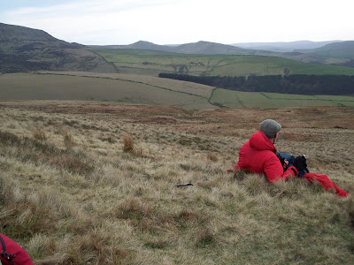
A quick stop and time for reflection.

Looking across to Mount Famine & South Head in the distance

where we had walked earlier this morning


Stepping back in history - Booth Sheepwash


Today was a superb day, I enjoyed it immensely. Ian, of course was very knowledgeable about the area and made it extremely interesting and everyone was such great company. Before the day was through I'd made up my mind to find out the dates for some more, hopefully equally interesting, walks in a week or two. Next weekend I'm off to Wales which is a pre-expedition training weekend before my Challenge next month - that seems so strange saying "next month" it's really crept up and getting scarily close now !

Friday, March 09, 2007

Past Project


Embroidered Pillows


The two printed panels were bought as "Di Van Niekerk" kits from, I think, a South African based company. The idea behind them being you buy the printed picture then use bits and pieces of leftover stranded cottons to embroider as much or as little as you want. Spare chintz fabric was used to finish them off by making them into little pillows.


The design area measures approx 18cm x 15cm. Stitches used: Stem/straight/satin stitch, french knots, bullion knots.


Sunday, March 04, 2007

Today was a miserable day on all counts. It was mostly my own fault though - I'd forgotten to pack my waterproof trousers and realised it 1/2 hour or so after setting off. I suppose I could have gone back for them at that point but as it looked fairly reasonable thought I might as well carry on and if it got too bad I'd just turn back and come home. Of course after a while it started to pour down. The wind was relentless with the rain was coming full pelt sideways.


Quite pleasant at the start, but as always the weather changes ever so quickly


There was a Fell Runner's competition on which I'd not realised and they seemed to be popping up like March Hares. I take my hat off to all of them, they've probably run three times the distance I've walked! My once lovely, comfortable, stout shoes started to let water in big time and I felt quite jealous as they went whizzing by, while I felt lead weights were attached to my feet as my shoes were so water logged.

Leaving the mist behind me


Heading back down towards Crowden


Crowden Great Brook


5 hours and 12 miles later I was more than pleased to arrive home, get a steaming hot shower and put on some dry clothes. I must admit listening to the wind howl outside while I'm all cosy inside doing a bit of my embroidery is much more satisfying tonight.

Saturday, March 03, 2007

Past Project - Blackwork

"The Embroideress"


This is a Blackwork project which I bought from Holbein Embroideries and completed ages and ages ago.


It's worked on 18 count Aida and the design area measures approx 18cm x 21cm (7" x 8 1/2").

******


Sunday, February 25, 2007

Although only 13.5 miles today's walk was much more tiring than yesterday's. Starting off crossing sections of deep bushy heather, then a rocky strewn incline followed by expanse of deep peat groughs certainly gives the calf muscles a good work out. I really noticed the difference of not having been to the gym this past fortnight and on the way back resolved to make sure no more excuses conjured for not going next week.


I'd previously decided to head over to Chew Reservoir and having reached the edge of Arnfield Moor stopped to take a bearing. Whilst perched on a stone, map in hand, I noticed a sheep edging forwards - aww cute I thought, sheep being skittish things that usually bolt at the slightest thing. Next moment another one, then another - then quite a few too many looking rather expectantly.

The Hills Have Eyes !!

Maybe Farmer Giles was a bit late with their food but they'd got a bit too close for comfort now. Waving my map and shouting "Shoo" didn't seem to be of much help only made them break out in a trot in my direction, not quite the effect I had in mind. Before I knew it there were twenty or so three feet away staring me out big time. Up off my rock like Jack Flash, fastening my bag while on the move I felt like the Pied Piper (except he wanted to be followed).


These lot seemed to have got their own ring leader - a mean looking one with rather large pointy horns and although I know they don't butt like goats I wasn't taking any chances when they found they weren't getting any food from me. Nothing for it but to to use the sheepfold as an escape route!


All that expanse of moorland what are they up to following me?


Dish Stone Rocks


Chew Reservoir

Chew reservoir - built in 1912. At 1600 ft above sea level is claimed to be the highest constructed reservoir in England.


By the water's edge - a peaceful spot to stop for lunch


Trig Point - Featherbed Moss


View from Trig Point - Don't you just wish you were there !!

Well at least its stopped raining